By Scott Robertson
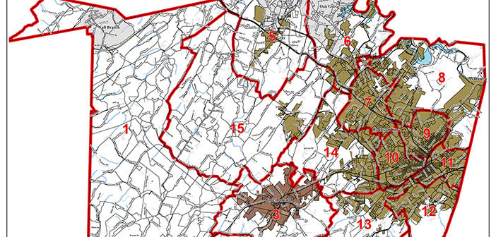
When the Washington County Commission’s Reapportionment Committee meets Sept. 15, it will consider a map that combines features from two previous maps into a “best of both worlds” approach. Committee members hope to be able to bring that map to the full county commission for consideration at its next regular meeting Sept. 21.
The new map leaves in place the western county districts of the first map the committee considered in July, while also taking features from the second map, including the inclusion of the west end of Gray with the rest of Gray in a single district.
Members of the full commission were given copies of the map during the August commission meeting so they would have time to consider it between then and the September meeting, even if they are unable to attend the Sept. 15 committee meeting.
“This map has a deviation (in population between the most and least populous districts) of 2.7 percent,” said Commissioner Joe Grandy, chair of the Reapportionment Committee. “We started out with 10 percent, so we’re definitely moving in a positive direction.”
There are 15 total districts, each to be represented by one commissioner. Said Grandy, “Our guiding principles were to keep deviation below 10 percent and to balance the districts that are all in the city with those that are all outside the city and those that have some portion in the city and some out.”
The map appears at right.


