Editor’s Note: This is the fourth in a series of five hikes that are available around our region. Hiking is a fun, safe way to get outdoors and get some exercise, especially during this time of social distancing.
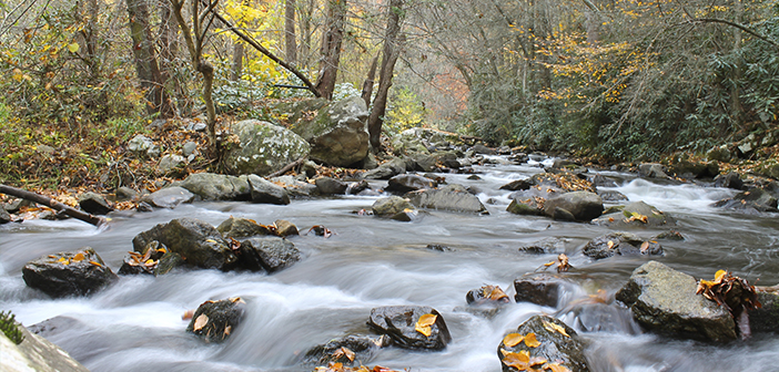
After a couple walks through the water and a jaunt through the highlands of Southwest Virginia, we split the difference this week with a trip to Doe River Gorge. The rolling water of the Doe River can be seen and heard well below the trail while steep peaks rise up to form the gorge.
Railroad enthusiasts will also enjoy walking along the narrow gauge rails that once carried trains full of iron ore through the gorge on their journey between North Carolina and Northeast Tennessee. Add in some fall colors, and this hike is a winner for beginners and seasoned hikers alike.

The description below is not exhaustive. A couple good resources to learn more include www.alltrails.com, and a local site by former Milligan College professor Mark Peacock, www.appalachiantreks.blogspot.com. Alltrails includes a free app that provides detailed maps and has articles on most hikes in this region, and Appalachian Treks’ descriptions, including directions, are excellent as well. And be sure to look up the “10 essentials” so you can hit the trail prepared.
Doe River Gorge (Carter County, TN)
Getting There: From Elizabethton, take U.S. Highway 19-E south to Hampton. 1.1 miles past the U.S. 321 intersection, turn left on Doe River Gorge Road. Proceed to Doe River Gorge Christian Camp’s main office to check in.
Distance: 4.7 miles (out and back)
How Strenuous: Easy
Parking: Plentiful parking is available at the camp.
Special Considerations: This trail is open to the public only from October through March. Hikers must get permission and sign a waiver at DRG Camp headquarters.
History, geology and scenic beauty combine in an easy stroll through a stunning river gorge. The region’s history fairly seems to emanate from the narrow gauge rails that guide hikers’ feet along a route once plied by the engines and cars of the East Tennessee and Western North Carolina railroad, better known as the Tweetsie. The highly successful Christian camp lends a relative degree of civilization and security for less experienced hikers unused to some of the region’s more remote trail experiences. Enter the gorge, though, and a strange sense of “safe remoteness” settles in.
After a short stroll past the camp’s amenities, a short tunnel greets visitors at the trail outset, adding a degree of wonder to the two-plus miles that await and hinting at the marvel of engineering this section of track represented when completed in the 1880s. Fascinating rock formations, sheer cliffs, forested coves and the winding river below all lend a storybook quality to this easy walk. It ends at an abandoned bridge where the Tweetsie’s trains once chugged across the river bearing iron ore, timber, people and goods from the mountains to Elizabethton and Johnson City.
The payoff: Simply being there. Short descents to the river are possible at several obvious points. Taking one affords yet one more magical perspective to the trip, but so does standing at a bend in the tracks with a beautifully folded rock wall behind you and high cliffs towering several hundred feet across the river from you. This is a great hike for beginners. Whether one walks the full distance or just part of it, the views are outstanding and, in the fall, offer a colorful palette of yellow, oranges and reds.
Next week’s edition of the News & Neighbor will feature the fifth and final hike in this five-part series.
Click to learn about Gentry Creek Falls, Lower Higgins Creek and Grayson Highlands hikes.


