By Scott Robertson
It’s back to the drawing board for the county and state staffers who’ve been working on creating a map delineating new Washington County Commission districts.
Two potential maps that would create districts for a 15-member commission (the commission currently has 25 members) were discussed at last Wednesday night’s meeting of the Reapportionment Committee. Both were found wanting by the six members of the ten-member committee in attendance.
Shrinking the commission has been a stated goal of a majority of commission members since voters elected a slate of commissioners who ran on the promise to do so last year.
The committee is charged with bringing to the full commission a map that:
1) has 15 districts
2) has a variance of less than 4 percent population from the largest district to the smallest
3) does not break up communities and neighborhoods
4) does not break up census blocks at any point in the county
5) has district lines that fall along the lines of the state house districts, to potentially allow for lowering the number of polling places, thereby cutting costs of elections
6) does not create an imbalance in the number of districts representing Johnson City, those that include both city and non-incorporated areas and those representing non-incorporated areas of the county
7) has compact districts that do not include odd shapes that might suggest gerrymandering.
The odds of creating a map that completely accomplishes all of those goals are remote. Only the stricture against breaking census blocks is mandated by law. The county must shrink the variance between districts, but as it currently is near 10 percent, it is unlikely that will become an issue.
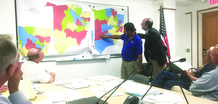
The first map presented at the meeting by Matthew Hill (not the Tennessee State House member of the same name), a geographic information system (GIS) specialist for the state comptroller’s office, had a variance of 2.4 percent. It was referred to as “the Community Plan.” (see picture, top right). The second, called, “Plan C,” had a variance of 3.3 percent (bottom right). Commissioners were told the names of the plans had no relevance to anything, that they were just working titles.
Hill’s office is assisting Chris Pape, the county zoning office’s GIS expert in designing the maps using software developed by Hill’s office.
After more than 45 minutes of discussion, the committee decided to ask Pape and Hill to create a hybrid map using features they liked from each of the first two drafts.
“If you could take the western half of the Community Plan and marry it to the eastern half of Plan C, the logical districting you have done makes more sense from a community point of view,” Commissioner Todd Hensley told Pape and Hill.
The western half of the Community Plan creates large, simply shaped districts for the unincorporated areas between a line from Gray to Jonesborough and the Greene County line. The eastern half of Plan C keeps Gray from being split into multiple districts.
“I think we have already shown we can bring the variance down significantly and that we can achieve a pretty decent balance between county, city and mixed districts,” said Commissioner Joe Grandy, committee chair. “I think right now we’re just working on the community aspects.”
The committee asked Pape and Hill to create a single map that keeps Districts 1, 2, 3 and 4 from the Community Plan and Districts 3, 4, 5, 6, 7, 8 and 9 from Plan C as close as possible to the way they were drawn in the drafts, using the rest of the new map to make up for any disparities created in the process.
Pape and Hill will now create a new map that still meets the original seven priorities while also making as few changes as possible to the specified districts from the Community Plan and Plan C maps.
Once the committee has the hybrid map, it will consider whether to send it to the full commission as-is, tweak it before sending it on to the commission, or reject it and restart.


